Contact Us
← All products Platform

Cyberspace Work

The field and office line of the CyberSpace platform.

Field crews and the office work from the same spatial record. What is captured on site is measured, annotated and signed off against the model, so progress, quality and handover read from one current record instead of a folder of exports.

ScenariosField · Office · Handover
Plans5, Starter to Enterprise
DeploymentPublic cloud / On-premises
StorageUp to 2 TB

From data capture
to field operations.

Five capabilities on one spatial intelligence platform. Every line of CyberSpace runs on the same set.

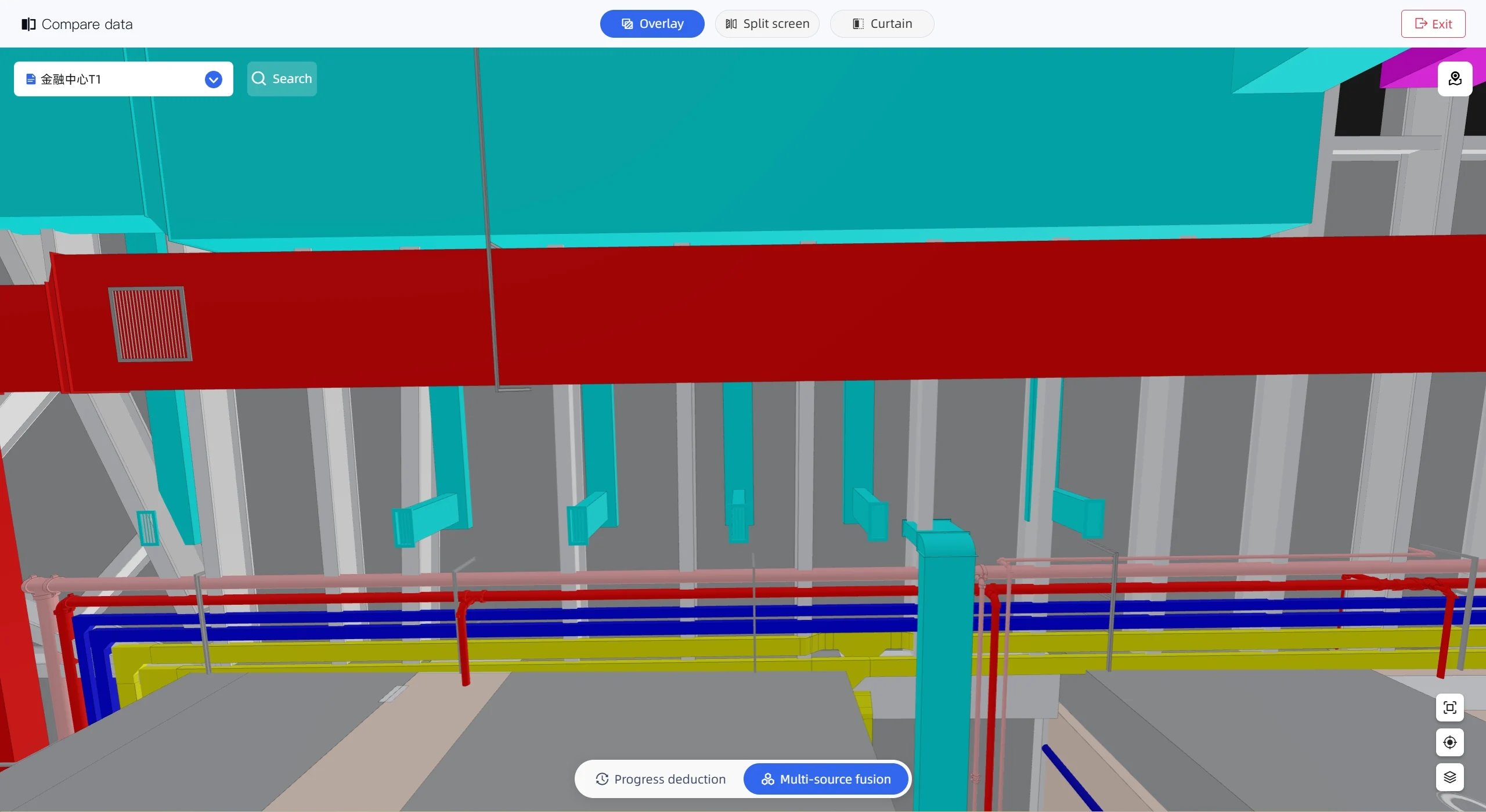
Multi-source Data Fusion

Unify BIM, Mesh, Point Cloud, 3DGS, GIS, vector, raster and IoT data in a single spatial database for seamless comparison and analysis.

  • One spatial database for BIM, 3DGS, GIS and IoT telemetry
  • Unified coordinate system with automatic data alignment
  • Query, slice and combine data across formats in real time

Open Hardware Ecosystem

Compatible with most major scanner and capture hardware brands. Authorized distributor and strategic technology partner of Hesai and NavVis.

  • Works with leading LiDAR, scanner, camera, UAV and GNSS devices
  • Authorized distributor & technology partner of Hesai and NavVis
  • Bring your own device, with no vendor lock-in
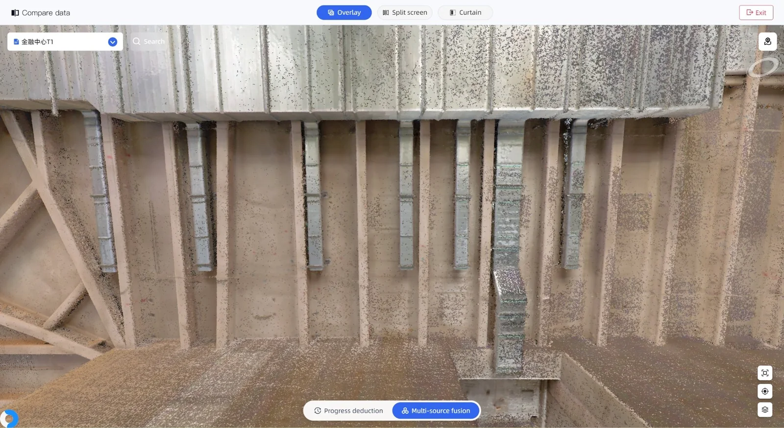
Reality-to-Model Comparison — BIM model view
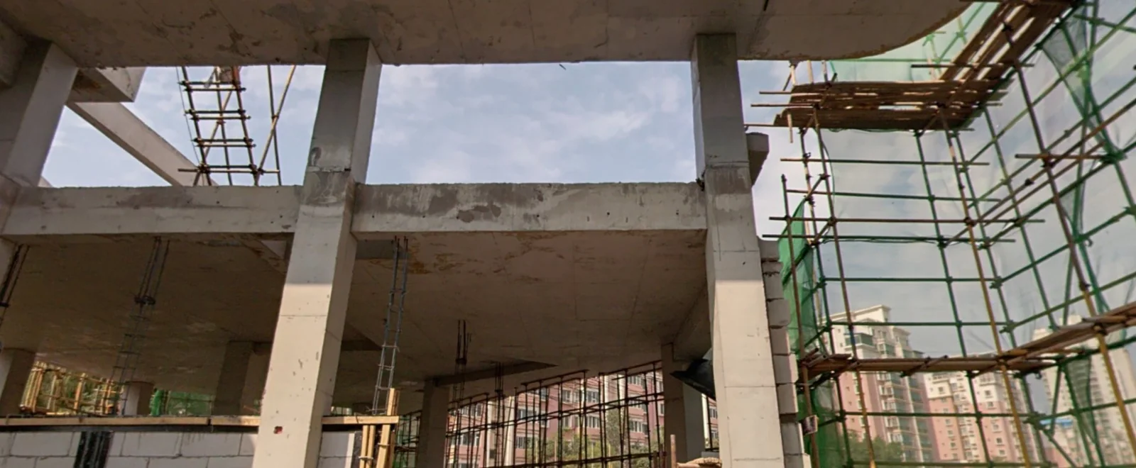
Reality-to-Model Comparison — captured reality view
Reality Model

Reality-to-Model Comparison

AI-based Scan-to-BIM and automatic comparison of point clouds with BIM models for deviation analysis, progress tracking and quality control.

  • AI-driven Scan-to-BIM model generation
  • Automatic point-cloud vs BIM deviation analysis
  • Progress tracking and quality-control reports
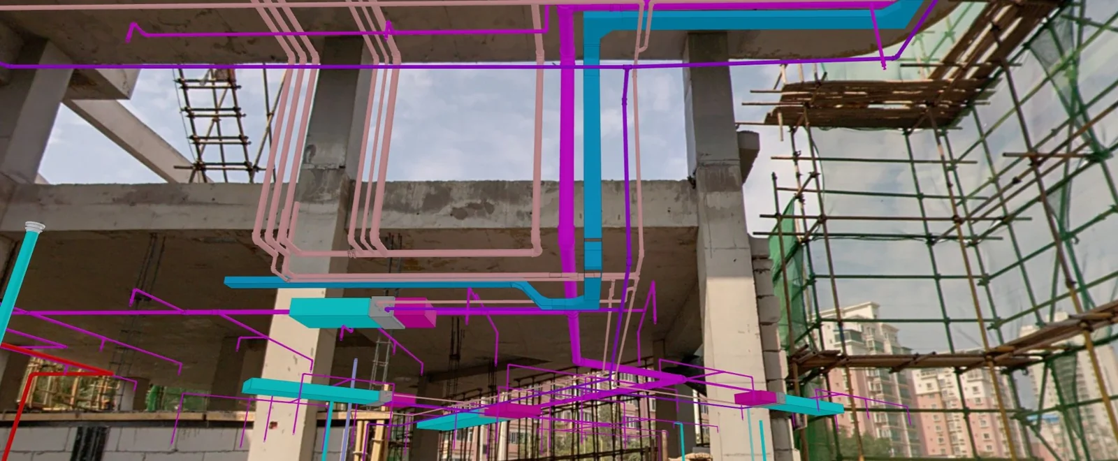
A concrete frame under construction, captured on site AR overlay of hidden services and BIM geometry on the same site
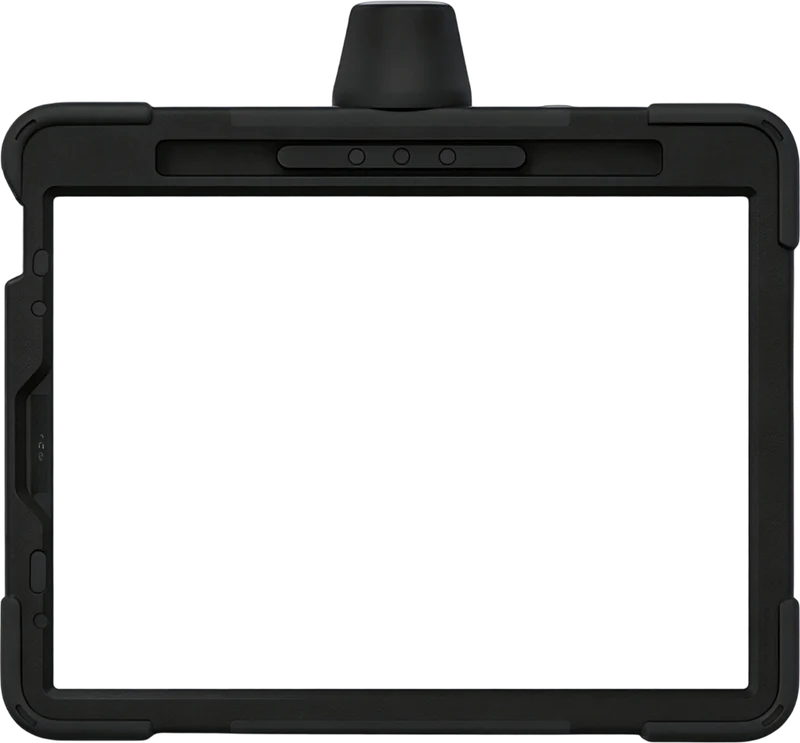
AR tablet

AR-Assisted Field Operations

Visualize hidden pipelines, equipment tags and BIM geometry on-site through AR, reducing errors and accelerating inspections.

  • Overlay hidden pipes, tags and BIM geometry on live video
  • Spatial anchors guide crews through standardized workflows
  • Fewer errors, faster inspections, measurable field productivity

IoT Asset Operations

Connect location, environmental, energy and equipment status data to spatial assets for lifecycle operation and maintenance management.

  • Bind telemetry to assets with full spatial context
  • Live status for location, environment, energy and equipment
  • Lifecycle operation and maintenance management

AI-Native Functions in Cyberspace

Scan to BIM, Scan to CAD, Data Compare, AI Analysis… Several Functions For You

AI-native cyberspace functions let you convert scans into BIM or CAD models, compare datasets, and run AI analysis. These tools support faster modeling, accurate comparison, and smarter insights for your workflows.

Plans & editions

Choose the plan
for your team.

Five plans on the CyberSpace platform, each with its own function set. Ultimate brings the AI Pro and AR Pro capabilities together.

Starter Unified spatial data viewing
Contact Us
  • DeploymentPublic cloud / On-premises
  • Storage500 GB
  • Project, Resource & Role Management
  • Multi-Phase Data Management
  • Multi-Source Data Upload & Viewing
  • GIS Map Integration
  • Floor Plan
  • Data Calibration & Alignment
  • Data Comparison
  • Spatial Partitioning
  • Coordinate Picking
  • Spatial Measurement
  • Spatial Anchors (POIs)
  • Navigation & Route Planning
Ideal for teams getting started with spatial data management.
AI Pro AI analysis + automated report
Contact Us
  • DeploymentPublic cloud / On-premises
  • Storage1 TB
  • Point Cloud Clipping
  • Point Cloud-to-Floor Plan
  • BIM Model Lightweighting
  • BIM Model Viewing
  • BIM Property Query
  • BIM Discipline-based Viewing
  • Reality-to-BIM Comparison
  • AI Analysis Report Export
  • Analysis Report Sharing
Advanced analysis and modeling for professional teams.
AR Pro AR-powered asset operations
Contact Us
  • DeploymentPublic cloud / On-premises
  • Storage1 TB
  • AR Code Management
  • Visual Positioning Map
  • AR + BIM Visualization
  • AR Overlay Comparison
  • AR Measurement
  • AI-Powered Analysis
  • Real-vs-Model Work Orders
  • AR-Based Acceptance
  • AR Inspection Workflows
  • AR Asset Operations & Maintenance
  • AR Verification Reports
  • Triple Shot
  • Manual Marking
AR-powered operations for field and asset teams.
Ultimate All AI Pro + AR Pro capabilities
Contact Us
  • DeploymentPublic cloud / On-premises
  • Storage2 TB
  • Multi-Source Spatial Data Fusion
  • Advanced Spatial Data Management
  • BIM & Digital Twin Management
  • Reality-to-Model Comparison
  • AI-Powered Spatial Analysis
  • AR-Powered Field Operations
  • AR Inspection & Acceptance
  • Work Order Management
  • Asset Operations & Maintenance
  • Integrated Reporting & Collaboration
The complete platform for multi-site operations.
Enterprise Enterprise customization
Contact Us
  • DeploymentPublic cloud / On-premises
  • StorageOn-Demand
  • Custom Function Development
  • API & System Integration
  • On-Premise Deployment
  • AR Workflow Customization
  • AI Model Customization
  • Custom IoT Integration
  • Custom Acceptance Workflows
  • Custom Inspection Workflows
  • Custom Asset O&M Workflows
Fully customized solutions for enterprise requirements.

Every plan is available as public-cloud SaaS or as an on-premises deployment. The pipelines versions are delivered offline.

For on-premises and offline deployment, software is provided under a perpetual license and requires customer-procured server infrastructure. Annual maintenance and support is provided under a separate agreement.

Talk to us about Cyberspace Work.

We will walk your team through the Work line, the plans behind it, and what it takes to run it in your environment.

Contact Us