Contact Us

Trusted on landmark
projects across Asia.

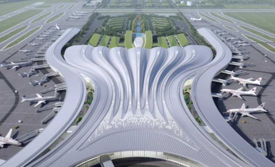
Aerial view of the Phase 3 terminal at Guangzhou Baiyun International Airport

CyberGEO AR Tech Drives Baiyun Airport Project Success

At Guangzhou Baiyun International Airport's Phase 3 expansion, CyberGEO's spatial AR construction verification checked ventilation ducts, high-mast lighting and aircraft stand signs against the BIM model across a 320,000 m² apron, without relying on QR codes. Task dispatch, dashboard tracking and triple-photo records kept owners, supervisors and contractors on one record.
Read the case study
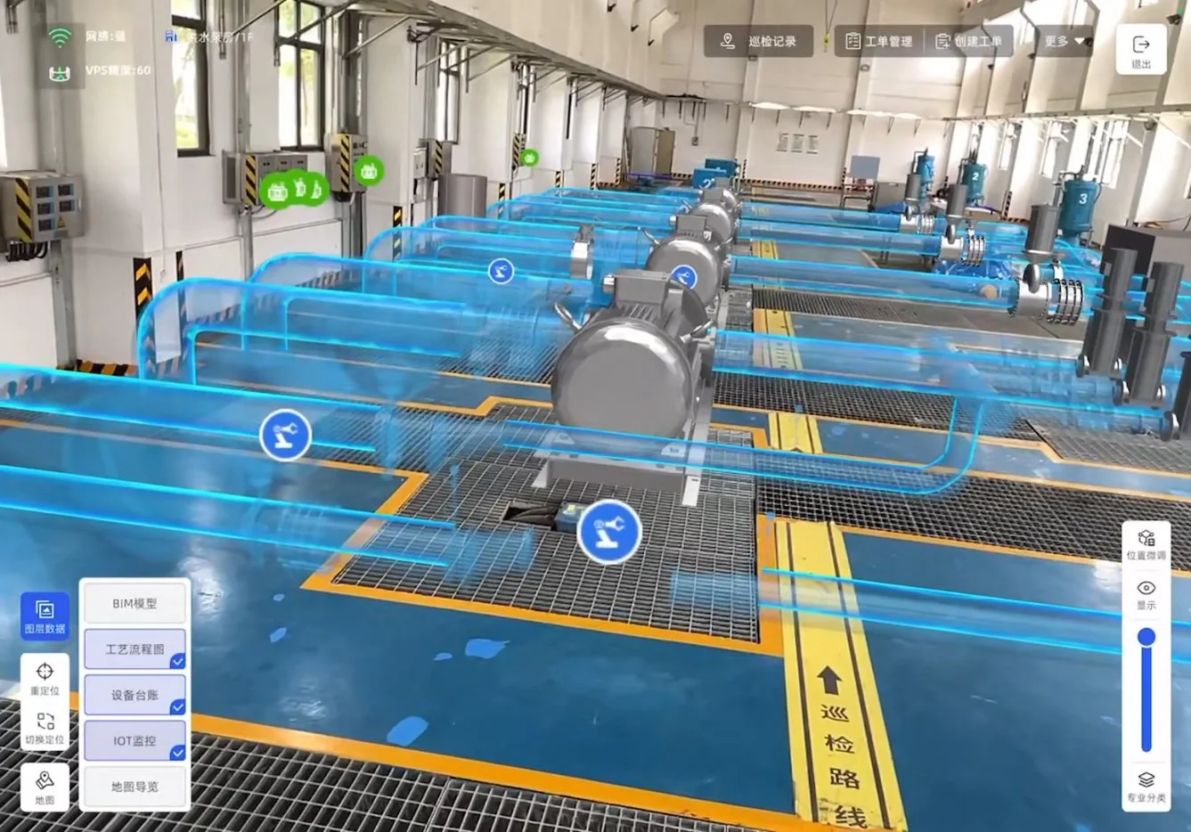
AR smart O&M at Shenzhen Water Technology's Guangming Water Plant

How AR Digital-Physical Fusion Helps Water Operations Teams Catch Conflicts Before They Reach the Site and Improve Inspection Efficiency

CyberSpace and Shenzhen Water Technology deployed an AR smart O&M system at Guangming Water Plant: a 1:1 reality-based digital twin, equipment lists and measurement points bound to spatial positions, and AR-guided inspection from task dispatch to recorded closure. Daily inspection efficiency +60%, equipment list lookup +80%.

Read the case study
3D archive of a gas pipeline captured before backfill in Wuhan

How AR 3D Reconstruction Keeps Buried Gas Assets Visible Before Backfill

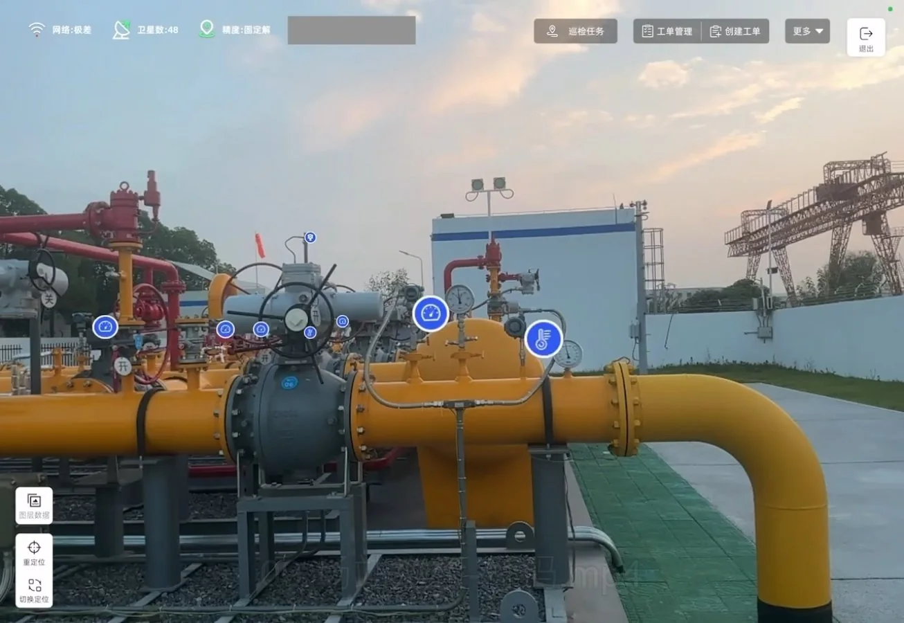
Once a gas trench is backfilled, what happened underground survives mostly in photos and memory. Wuhan Chengtou Energy Group captures the site in 3D first: a measurable as-built archive, GIS history and models overlaid on the real street through AR Pad, and a station-level digital twin. Field capture for a typical 1 km segment dropped from several days to 1 hour.

Read the case study

Spatial projects, captured as built.

Each site digitized end to end, from the first scan to a 3D record you can measure, query and update.