
 Cyberspace Work
 Cyberspace Pipeline
 Hesai Kosmo One
 NavVis MLX
 Handheld AR
 AR Pad
 All-in-One Appliance
 Buildings
 Rail & Transit
 Underground Pipelines
 Indoor Pipelines
 Industrial Plants
 Commercial Complexes
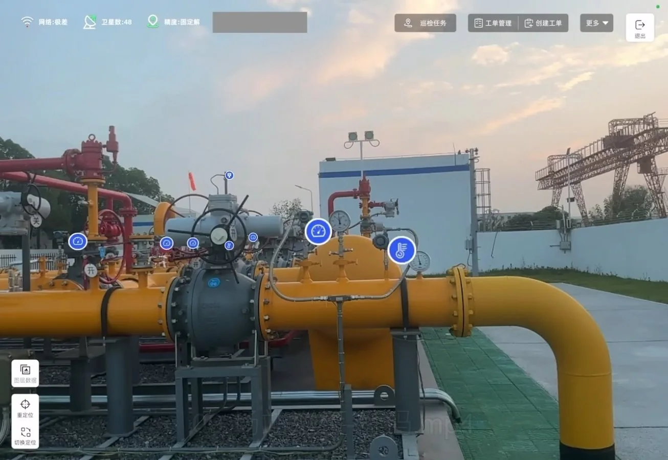
For engineering and operations teams at Wuhan Chengtou Energy Group in Wuhan, China, the daily reality is a familiar one: a gas pipeline trench is dug, inspected, and backfilled, and much of what happened underground is preserved only in paper records, photos, and the memory of the crew on site. Simple projects can get by with that approach. But as underground networks become denser and station equipment more complex, missing details lead to rework, safety risks, and costly site revisits. That is where CyberSpace’s integrated satellite-inertial-vision high-precision positioning, 3D reality modeling, and AR technology entered the picture. The team began using the platform to capture construction sites before backfill and turn them into measurable 3D digital records.
“Before, once the trench was backfilled, we were often working from photos, drawings, and memory,” says a project manager. “Now we can go back to the model and see what was actually there.”
1. Bringing the real underground site into the construction and O&M workflow
Traditional gas pipeline projects rely on manual records, design drawings, and spot photos. These methods can document that work happened, but they rarely preserve enough spatial detail for later inspection, maintenance, or dispute resolution. If a crew needs to verify pipe depth, check a weld, or compare as-built conditions with the design, the original site may already be covered.
CyberSpace’s workflow changes that by digitally capturing key construction nodes before backfill. In the Yongjinfu gas pipeline project, the team used 3D reconstruction to create a digital construction archive and a 3D model of the underground installation. Instead of relying on a few images, managers can review pipe width, burial depth, weld details, valve status, and the relationship between components in a measurable digital environment.
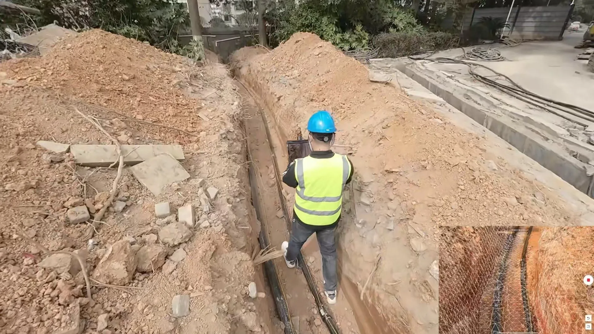
The difference is practical. For a typical 1 km pipeline segment, field capture that once required several days of manual measurement and documentation can be completed in 1 hour. These numbers are project-specific, but the direction is consistent: less time chasing missing information, fewer trips back to site, and less rework.
“We used to send someone back to the site just to confirm one depth or one weld,” says a field supervisor at the company. “Now the answer is already in the model.”
For business teams, the value shows up in time, cost, labor, and rework reduction. A digital archive also gives managers a traceable record if a quality issue appears later. Instead of debating what might have happened, they can review what was captured.
2. Making the proposed pipeline design easier to understand
One of the less obvious benefits is how 3D and AR change communication. A design drawing can be accurate and still be hard for non-engineers to interpret. When the proposed pipeline model is overlaid on the real environment through AR Pad, field crews, project managers, and other stakeholders can see the same thing in context.
In projects such as Shenlong Avenue and Tianxi Shangyuan community, CyberSpace’s platform maps GIS historical data and 3D models into the real world. Teams can compare pipeline routes, valve chambers, burial depth, and nearby hazards directly against the site. During emergency repairs or cross-construction, the overlay gives crews a clearer reference before they dig.
“The drawing says one thing, but the site says another,” says an operations engineer at Wuhan Chengtou Energy Group. “When you see the model on top of the real ground, the discussion becomes much faster.”
This shared view reduces the back-and-forth that happens when different teams interpret separate documents. It also helps customers and internal stakeholders review a proposed plan without needing to visualize it from a 2D sheet.
3. Helping customers do it themselves
CyberSpace’s role is not limited to delivering a one-time scan or a finished model. The platform is designed to help customer teams capture, review, and use digital assets in their own daily workflows. Field staff can operate AR Pad to view equipment locations, pipeline routes, and inspection tasks. Managers can set inspection plans on the AR digital-physical platform and track whether tasks are completed.
That shift, from a service provider doing everything to customer teams being able to run more of the process themselves, opens new paths. Utilities can build internal digital archive capabilities, offer better-documented maintenance services, and use captured data for planning, training, and audits.
“At first we thought this would be a specialist tool,” says a maintenance team lead. “But our inspectors were able to use it after one day of training.”
Ease of use matters. If the tool is too complex, it will not survive daily operations. The goal is to make digital capture and AR review a normal part of the job, not a separate project.
4. Taking the same idea beyond gas pipelines
The challenge Wuhan Chengtou Energy Group faced is not unique to underground pipelines. Water utilities, power grids, telecom networks, and industrial plants are no exception. Many of them still rely on paper records, scattered photos, and institutional memory.
The adoption trend is moving toward digital twins and AR-assisted field workflows because the underlying problem is universal. In the Zhuankou high/medium-pressure regulating station, CyberSpace integrated BIM models, 3D laser point clouds, panoramic images, and IoT sensor data to create a station-level digital twin. Managers can plan inspections, while frontline staff use AR Pad to view equipment in real place and access real-time equipment data. It is an early example of how the same idea can extend from pipelines to stations, and from gas to other asset-heavy industries.
“The technology is not just for showing something pretty,” says a senior engineer at the company. “It is for helping people make better decisions on site.”
Conclusion
For gas pipeline operators, the common challenge is simple: the most important details are often the hardest to see after the work is finished. Paper records and human experience can only carry so much. By capturing the real site in 3D before backfill and making it accessible through AR, CyberSpace helps teams reduce site revisits, speed up quantity calculations, improve quality control, and give distributed teams a shared view of the same underground reality.
Explore the CyberSpace Pipeline Digitalization Solution to see how it fits your projects.